Installations
npm install @syncfusion/ej2-angular-mapsDeveloper Guide
Typescript
No
Module System
ESM
Node Version
10.24.1
NPM Version
6.5.0
Score
77.5
Supply Chain
95.6
Quality
96
Maintenance
100
Vulnerability
60
License
Releases
Contributors
Unable to fetch Contributors
Languages
TypeScript (96.45%)
SCSS (2.85%)
JavaScript (0.7%)
Love this project? Help keep it running — sponsor us today! 🚀
Developer
Download Statistics
Total Downloads
475,351
Last Day
518
Last Week
2,559
Last Month
15,500
Last Year
133,397
GitHub Statistics
279 Stars
368 Commits
115 Forks
44 Watching
1 Branches
21 Contributors
Bundle Size
1.23 MB
Minified
294.32 kB
Minified + Gzipped
Maintainers
Package Meta Information
Latest Version
28.1.38
Package Id
@syncfusion/ej2-angular-maps@28.1.38
Unpacked Size
409.41 kB
Size
72.31 kB
File Count
45
NPM Version
6.5.0
Node Version
10.24.1
Publised On
07 Jan 2025
Total Downloads
Cumulative downloads
Total Downloads
475,351
Last day
8.8%
518
Compared to previous day
Last week
-32.8%
2,559
Compared to previous week
Last month
9.3%
15,500
Compared to previous month
Last year
5.6%
133,397
Compared to previous year
Daily Downloads
Weekly Downloads
Monthly Downloads
Yearly Downloads
Angular Maps Component
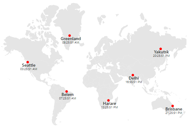
The Angular Maps component is used to visualize geographical data and represent statistical data of a specific geographical area on earth with user interactivity, and it provides a wide range of customization options.
Getting started . Online demos . Learn more
Trusted by the world's leading companies

Setup
Create an Angular Application
You can use Angular CLI to setup your Angular applications. To install the Angular CLI, use the following command.
1npm install -g @angular/cli
Create a new Angular application using the following Angular CLI command.
1ng new my-app
2cd my-app
Adding Syncfusion Maps package
All Syncfusion Angular packages are available in npmjs.com. To install the Angular Maps package, use the following command.
1npm install @syncfusion/ej2-angular-maps
The above command does the below configuration to your Angular app.
- Adds
@syncfusion/ej2-angular-mapspackage and its peer dependencies to yourpackage.jsonfile. - Imports the
MapsModulein your application moduleapp.module.ts. - Registers the Syncfusion UI default theme (material) in the
angular.jsonfile.
This makes it easy to add the Syncfusion Angular Maps module to your project and start using it in your application.
Add Maps component
In src/app/app.component.ts, use <ejs-maps> selector in the template attribute of the @Component directive to render the Syncfusion Angular Maps component.
1import { Component } from '@angular/core';
2import { world_map } from './world-map';
3
4@Component({
5selector: 'app-container',
6template:
7`<ejs-maps id='maps-container'>
8    <e-layers>
9        <e-layer [shapeData] = 'shapeData'></e-layer>
10    </e-layers>
11</ejs-maps>`
12})
13
14export class AppComponent {
15  public shapeData: object = world_map;
16}
Supported frameworks
Maps component is also offered in the following list of frameworks.
 JavaScript |  React |  Vue |  ASP.NET Core |  ASP.NET MVC |
|---|
Showcase samples
Key features
- Data sources: Binds the maps control to an array of JSON objects containing GeoJSON data.
- Map providers: Online map providers such as OpenStreetMap, Bing Maps and others can also be rendered.
- Layer: Layer represents the area which renders the map. Also, any number of layers can be added.
- Projection: Maps can be rendered in eight different types of projections.
- Drill-down: Provides drill-down option to have a closer look at the lower level of a hierarchy.
- Marker: Provides support to mark a specific place of interest in the map.
- Data label: Provides additional information about the shapes in the form of text over the shapes.
- Bubble: Represents visually the underlying data values of the shapes.
- Navigation line: Denotes the path between two locations.
- Color mapping: Applies colors to the shapes based on various conditions. Maps supports three types of color mapping: range color mapping, equal color mapping and desaturation color mapping.
- Legend: Summarizes the information from the layers, markers and bubbles.
- Annotation: Uses any custom HTML element as annotation and place it anywhere on the maps.
- Selection and highlight: Supports selecting or highlighting shapes to bring center of attraction.
- Zooming and panning: Allows to zoom in, zoom out, and pan the map to show in-depth information.
- Tooltip: Provides additonal information about the shapes on hover.
- Print and Export: Prints or exports the rendered maps to a desired format. Exporting supports four formats: PDF, PNG, JPEG and SVG.
- Templates: Templates can be used to create custom user experiences in the Maps.
- Globalization: Personalize the Maps component with different languages, as well as culture-specific number, date and time formatting.
- Accessibility: Provides with built-in accessibility support which helps to access all the Maps component features through the keyboard, screen readers, or other assistive technology devices.
Support
Product support is available through the following mediums.
- Support ticket - Guaranteed Response in 24 hours | Unlimited tickets | Holiday support
- Community forum
- GitHub issues
- Request feature or report bug
- Live chat
Changelog
Check the changelog here. Get minor improvements and bug fixes every week to stay up to date with frequent updates.
License and copyright
This is a commercial product and requires a paid license for possession or use. Syncfusion® licensed software, including this component, is subject to the terms and conditions of Syncfusion® EULA. To acquire a license for 80+ Angular UI components, you can purchase or start a free 30-day trial.
A free community license is also available for companies and individuals whose organizations have less than $1 million USD in annual gross revenue and five or fewer developers.
See LICENSE FILE for more info.
© Copyright 2025 Syncfusion® Inc. All Rights Reserved. The Syncfusion® Essential Studio® license and copyright applies to this distribution.

No vulnerabilities found.
Reason
13 commit(s) and 0 issue activity found in the last 90 days -- score normalized to 10
Reason
0 existing vulnerabilities detected
Reason
no binaries found in the repo
Reason
license file detected
Details
- Info: project has a license file: license:0
- Warn: project license file does not contain an FSF or OSI license.
Reason
Found 0/30 approved changesets -- score normalized to 0
Reason
no effort to earn an OpenSSF best practices badge detected
Reason
security policy file not detected
Details
- Warn: no security policy file detected
- Warn: no security file to analyze
- Warn: no security file to analyze
- Warn: no security file to analyze
Reason
no SAST tool detected
Details
- Warn: no pull requests merged into dev branch
Reason
project is not fuzzed
Details
- Warn: no fuzzer integrations found
Score
5
/10
Last Scanned on 2025-01-27
The Open Source Security Foundation is a cross-industry collaboration to improve the security of open source software (OSS). The Scorecard provides security health metrics for open source projects.
Learn MoreOther packages similar to @syncfusion/ej2-angular-maps
@syncfusion/ej2-angular-diagrams
Feature-rich diagram control to create diagrams like flow charts, organizational charts, mind maps, and BPMN diagrams. Its rich feature set includes built-in shapes, editing, serializing, exporting, printing, overview, data binding, and automatic layouts.
@syncfusion/ej2-ng-maps
The Maps component is used to visualize the geographical data and represent the statistical data of a particular geographical area on earth with user interactivity, and provides various customizing options for Angular